Download
1 / 51
530 likes | 711 Vues
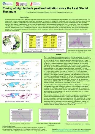
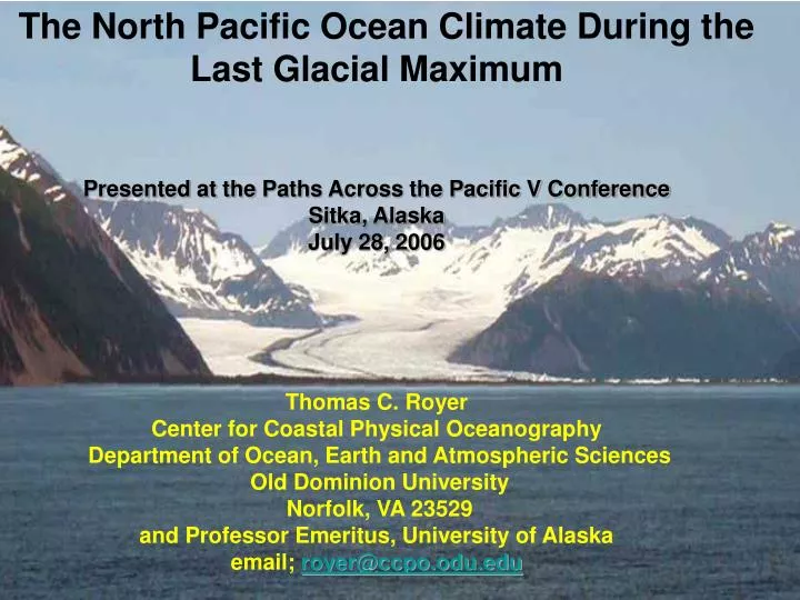
The North Pacific Ocean Climate During the Last Glacial Maximum Presented at the Paths Across the Pacific V Conference Sitka, Alaska July 28, 2006 Thomas C. Royer Center for Coastal Physical Oceanography Department of Ocean, Earth and Atmospheric Sciences Old Dominion University

E N D
The North Pacific Ocean Climate During the Last Glacial Maximum Presented at thePaths Across the Pacific V Conference Sitka, Alaska July 28, 2006 Thomas C. Royer Center for Coastal Physical Oceanography Department of Ocean, Earth and Atmospheric Sciences Old Dominion University Norfolk, VA 23529 and Professor Emeritus, University of Alaska email;royer@ccpo.odu.edu
Use of ocean physics to support the concept of early human migration using a coastal route
Present Conditions • Relate to Past Conditions • Future Studies
Use the Present to Reconstruct the Past Studies of present oceanographic processes in the northern North Pacific Ocean will allow the understanding past marine conditions. Physical processes driving the ocean circulation today are similar to those processes that took place many millenniums ago.
Begin by looking at the physics of coastal ocean circulation in the northern North Pacific Two Important Physical Concepts 1. Water runs “downhill” 2. Water flows turn to the right: The rotation of the earth turns the currents to the right in the northern hemisphere also known as Coriolis acceleration.
Present Characteristics of the Alaska Coastal Current Width – about 30 kilometers (18 miles) Length – Columbia River to Bering Strait Speed – 25-180 cm/second (0.5 - > 3 knots) Direction – Cyclonic (counterclockwise, N) Depth – 50-100 meters (150-300 feet)
GAK1 OSP
Recent increases in glacial ablation (Arendt, et al. 2002) have decreased the salinity, increased the transports and temperatures.
Freshwater Discharge + - Cyclonic Activity Salinity + - + Heat Advection Hydrologic Cycle for Gulf of Alaska From Royer, et al., 2001
The Simplified Two Layer Explanation For this two layer system (0-100m and 100-250) there is a significant (C.I.> 99.) increase in temperature of +0.034 degrees C per year (+/- 0.004) in the upper layer and +0.027 degrees C per year (+/- 0.004) in the lower layer. Thus over the 33 year record, the temperature anomaly has increasedby about 1 degree C! The salinity decreased in the upper layer at a rate of -0.0029 per year (+/- 0.0015) (C.I. > 90) and increased in the lower layer at a rate of +0.0025 per year (+/-0.0009) (C.I.>90). This suggests an increased stratification, increasing the transport that causes increased advection of heat from the south along coastal Gulf of Alaska. Of course, this has climate change implications.
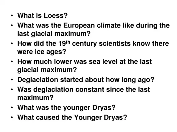
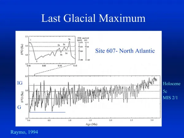
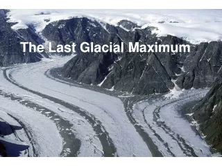
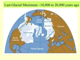
What were the climatic conditions over the North Pacific in the midst of the Last Glacial Maximum?
Last Glacial Maximum - Preindustrial Temperatures (Otto-Bliesner, et al., 2006)
Zonally Averaged Temperature Changes of CCSM3 Slab and Coupled Models (Otto-Bliesner, et al.,2006)
Differences in Sea Ice Thicknesses (m) During LGM Compared With PI (Otto-Bliesner et al., 2006)
Annual Atlantic Ocean Mean Wind Stress (dynes/sq.cm) (Otto-Bliesner et al., 2006)
Temperature-Salinity Profiles for LGM and PI (dashed) (Otto-Bliesner et al., 2006)
Characteristics of the Alaska Coastal Current during LGM Width – less than 15 kilometers ( 9 miles) Length – Columbia River to Kamchatka Speed – 3-18 cm/second (0.06 - > 0.3 knot) Direction – Cyclonic (counterclockwise, N) Depth – 5-10 meters (15-30 feet)
Dixon, 2003 Potential Migration Path of Early Americans, 18,000 BP
THE PREVAILING WINDS AND CURRENTSOF THE WORLD'S OCEANS ANDTHE SEA ROUTES NAVIGATORSWOULD HAVE USED The Atlantic Ocean could not have been home to Atlantis 11,500 years ago, but it could have been a sea-way, a virtual conveyor belt to the “lost continent.” It is far easier to sail across the Atlantic from Iberia to the Americas under steady winds and a favouring current than it is to sail even half that distance in the Mediterranean where currents are tricky and winds can blow hard from any direction and then dissipate into a sailors’ nightmare – a complete calm. From Atlantis in America – Navigators of the Ancient World by Ivar Zapp and George Ericson
From “Warmings in the far northwestern Pacific promoted pre-Clovis Immigration in America during Heinrich event II” (Samthein, et al., 2006) Possible Clovis and pre-Clovis paleoindian migration routes, (Clovis= dashed)
Necessary Pleistocene Nautical Skills Ability to move people and limited cargo Ability to move against the winds and currents Ability to follow the coastline Ability to follow the marine ecosystem
Prehistoric Boats Coracles From www.gallica.co.uk/celts/boats.htm
Basic Boat Types 1. Raft – not very sea worthy as Thor Heyerdahl proven 2. Skin – limited endurance, advanced design attained rapidly 3. Bark – complicated construction, tools needed 4. Dugout – simplest, but open ended
Log Boat From www.gallica.co.uk/celts/boats.htm
Umiak Bone or wooden frame with skin covering Uses local materials found at high latitudes
Umiaks • Primitive boats constructed from animal hides • Frame work of wood or bone • Lashed together • Did not require advanced tools for their construction • Inverted animal tents • Lightweight • Capable of carrying significant loads
Disadvantages of skin boats • (associated with their walrus skin covers) • Walrus can puncture the covers • Walrus skins need to be replaced every year or two • After 24-36 hours in the water, the skins become waterlogged, • heavy, begin to leak and require drying out. • (Braund,1988)
The Late Pleistocene Yacht Club From The First Americans by Adovasio and Page, 2002
ALBAN SKIN-COVERED VESSEL This cut-away drawing gives an impression of the construction and carrying capacity of a fifty-foot, skin-covered vessel of Alban type. From The Alban Quest – The search for the lost tribe – by Farley Mowat
Dixon, 2003 During the LGM (18,000 BP) ACC was minimal, allowing easy migration southward in primitive skin boats. Sea level was also about 120 m lower.
Sea Level At Last Glacial Maximum (LGM) http://www.geo.umass.edu/beringia/index.html
A paleosalmoncentric society would have settlements centered on today’s drowned river valleys along the shelf break.
Corak From www.gallica.co.uk/celts/boats.htm