AgriSatellite: Global Crop Monitoring Guide
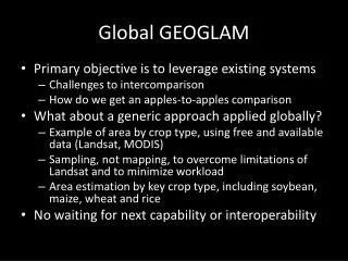
Explore preliminary GEOGLAM inputs compiled from various sources, continuously refined by the team. Spatial resolution, data sources, and timing are detailed for crop mask data. These datasets serve as guides awaiting community validation.

AgriSatellite: Global Crop Monitoring Guide
E N D
Presentation Transcript
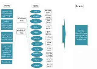
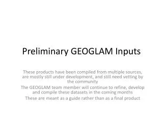
Preliminary GEOGLAM Inputs These products have been compiled from multiple sources, are mostly still under development, and still need vetting by the community The GEOGLAM team member will continue to refine, develop and compile these datasets in the coming months These are meant as a guide rather than as a final product
WHERE? Cropmask Sources: USGS NLCD (USA), CORINE (Europe), Africover (Africa), South Africa, Zimbabwe (national products), MODIS UMD MCD12q1 (rest of world). compiled by UMD
AT WHAT LEVEL OF DETAIL(SPATIAL RESOLUTION)? Data Source: IIASA, Ecosystems Services & Management, based on interpolation of 50,000 IIASA GEOWIKI collected validation points
WHEN? Data source: UMD crop calendar (USA), SAGE crop calendar (rest of world)
WHEN? Data source: UMD crop calendar (USA), SAGE crop calendar (rest of world)
HOW OFTEN? Data source: UMD, based on MODIS Terra data from 2000-2011
HOW OFTEN? Data source: UMD, based on MODIS Terra data from 2000-2011