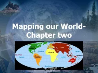
Discovering Earth: Latitude and Longitude Mapping Skills Lab
Experience hands-on map-making skills by drawing detailed maps from your classroom to a chosen location. Learn about latitude, longitude, and how to locate any place on our planet. Test your mapping abilities and enhance your geographical knowledge.


Discovering Earth: Latitude and Longitude Mapping Skills Lab
E N D
Presentation Transcript
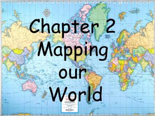
Chapter Introduction • Chapter Introduction • Lesson 1: Latitude and Longitude • Lesson 2: Types of Maps • Lesson 3: Remote Sensing • Chapter Assessment
BIGIDEA • Earth scientists use mapping technologies to investigate and describe the world.
LaunchLAB • Can you make an accurate map? • If you have ever been asked to give someone directions, you know that it is important to include as many details as possible so that the person asking for directions will not get lost. Perhaps you drew a detailed map of the destination in question. Test your map-making skills in this lab.
Complete lab activity by following the rules and instructions provided. You will have 20 minutes to complete the first part of the lab.
Can you make an accurate map? • If you have ever been asked to give someone directions, you know that it is important to include as many details as possible so that the person asking for directions will not get lost. Perhaps you drew a detailed map of the destination in question. • Procedure [no safety symbols] • Read and complete the lab safety form. • With a classmate, choose a location in your school or schoolyard. • Use a sheet of graph paper and coloredpencils to draw a map from your classroom to the location you chose. Include landmarks such as drinking fountains and restrooms. • Share your map with a classmate. Compare the landmarks you chose and the path each of you chose to get to your locations. If they were different, explain why.
Latitude and Longitude Finding your location throughout the world!
What is Latitude? • Latitude is defined as a measurement of distance in degrees north and south of the equator • The word latitude is derived from the Latin word, “latus”, meaning “wide.”
What is Latitude? There are 90 degrees of latitude from the equator to each of the poles, north and south. • Latitude lines are parallel, that is they are the same distance apart • These lines are sometimes referred to as parallels.
The Equator • The equator is the longest of all lines of latitude • It divides the earth in half and is measured as 0° (Zero degrees).
North and South Latitudes • Positions on latitude lines above the equator are called “north” and are in the northern hemisphere. • Positions on latitude lines below the equator are called “south” and are in the southern hemisphere.
Quiz Time Lines of latitude are ______________ to the equator?
There are __________ degrees of latitude north and south of the equator.
The equator is at __________ degrees.
Another name for latitude lines is ______________.
What is Longitude? • Longitude is defined as measurement of distance in degrees east or west of the prime meridian. • The word longitude is derived from the Latin word, “longus”, meaning “length
What is Longitude? • The Prime Meridian, as do all other lines of longitude, pass through the north and south pole. • They make the earth look like a peeled orange.
The Prime Meridian • The Prime meridian divides the earth in half too. • It is also 0°. It passes through the community of Greenwich, England
The International Date Line • There are 180 lines of longitude on each side of the prime meridian. • But on the opposite side, the primer meridian is not zero degrees but 180°. • It is called the International Date Line.
East and West Longitudes • Longitude lines to the left of the prime meridian give locations west, in the western hemisphere. • Longitude lines to the right of the primer meridian give locations east, in the eastern hemisphere.
Here’s another quiz! Longitude lines connect the _____________ pole with the ____________ pole.
The line of 0° longitude is called the _________ ___________.
Longitude lines give directions ________________ and ________________ of the prime meridian.
There are _____________ degrees of longitude on each side of the prime meridian.
Longitude lines are not ______________ like latitude lines.
Using Latitude and Longitude • To fine your exact location on a map, you need to determine which latitude line and which longitude line meet where you are standing. • When writing locations, the latitude is given first. – For example • Miami, Florida, has a location of 25° North and 80° West. • This is usually written in a short form as 25° N 80° W
Lets Practice • Give the Latitude and Longitude of each of the following shapes. – Viking Ship________ – Hurricane_________ – Tourist___________ – Rafter____________ – Whale____________ – Canoeists_________ – Flying Bird_________
The line at 0° Longitude is called what?
Longitude and Latitude are measured in what?
What is the degrees latitude of the equator?