Understanding Latitude, Longitude, and Cartography of Our World
This chapter introduces the fundamentals of cartography, focusing on latitude and longitude as the primary tools for locating points on Earth. It explains how the equator divides the planet into hemispheres and describes the significance of each degree of latitude and longitude. The division of Earth into 24 time zones based on its rotation is detailed, alongside information about different map types, including Mercator and topographic maps, and the role of remote sensing technologies. Gain insights into how maps represent geographical features and how modern technology aids in navigation.

Understanding Latitude, Longitude, and Cartography of Our World
E N D
Presentation Transcript
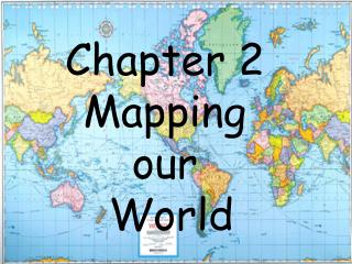
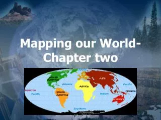
Latitude and Longitude A. The science of mapmaking is called cartography. 1. Cartographers use an imaginary grid of parallel lines and vertical lines to locate points on Earth exactly.
2. The equator circles Earth halfway between the north and south poles. 3. The equator separates Earth into two equal halves called north and south hemispheres.
B. Latitude 1. Lines running parallel to the equator are called latitude. 2. Latitude is the distance in degrees north or south of the equator. 3. The equator is a reference point numbered at 0 degrees latitude.
C. Degrees of Latitude 1. Each degree of latitude is equivalent to about 111km on Earth’s surface.
D. Longitude- east and west 1. Longitude is the distance in degrees east or west of the prime meridian, which is the reference point for longitude.
3. Unlike lines of latitude, lines of longitude are not parallel. They are large semicircles that extend vertically from pole to pole 4. Both latitude and longitude are needed to precisely locate positions on earth.
E. Time Zones 1. Earth is divided into 24 time zones. Why? Earth takes 24 hours to rotate on its axis. That is why there are 24 time zones.
F. Calendar dates 1. Each day ends and the next day begin at the stroke of mid night. 2. The International Date Line, or 180 degrees meridian, serves as the transition line for calendar days.
3. If you were traveling west across the International Date Line, you would advance your calendar one-day. 4. If you were traveling east, you would move your calendar back one-day.
II. Types of Maps A. Maps are flat of three-dimensional object, Earth. 1. A Mercator projection is a map that has parallel lines of latitude and longitude. 2. Projecting points and lines from globe onto a cone makes a conic projection
3. A gnomic projection is made by projection points and lines from a globe onto a piece of paper that touches the globe at a single point.
4. Detailed maps showing the hills and valleys of an area are called topographic maps. 5. Elevation on a topographic map is represented by a contour line.
6. Contour line connects points of equal elevations. 7. The difference in elevation between two side-by-side contour lines is called the contour interval.
8. Numbers representing their elevations marks some contour lines. 9. Depression contour lines are used to represent such features as volcanic craters and mines.
A. Map legends 1. A map legend explains what symbols represent.
2. A map scale is the ratio between distances on a map and actual distances on the surface of Earth.
III. Remote sensing A. Electromagnetic spectrum 1. 1. Process of collecting data about earth from far above the earth surface is called remote sensing. 2. Satellites detect different wavelengths of energy reflected or emitted from earth’s surface.
3. All electromagnetic waves travel at the speed of 300 00 km/s – speed of light. 4. The arrangement of electromagnetic radiation according to wavelengths is called electromagnetic spectrum.
5. An electromagnetic wave also can be described according to its frequency, which refers to then umber of waves that pass a particular point each second
B. Landsat satellites 1. A landsat satellite receives refelcted wavelengths of energy emitted by earth’s surface, including some wavelengths of visible light and infrared radiation.
2. Other satellites, such as the Topex/Posedon satellite, use radar to map features on the ocean floor
3. The global positioning system (GPS) is a radio-navigation system of at least 24 satellites that allows its users to determine their exact position on earth.
1. 4. Sea beam technology is located on a ship rather than a satellite. 5. Sea beam relies on sonar-sound waves