Download
1 / 2
20 likes | 144 Vues
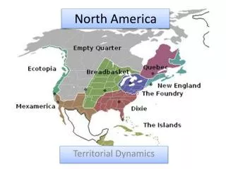
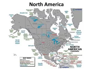
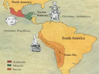
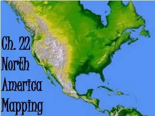
In this activity, you will create a detailed map of North America by labeling and coloring key geographical features. Use appropriate colors: blue for bodies of water such as the Atlantic and Pacific Oceans, brown for mountainous regions like the Rockies and Appalachians, and green for plains. Include the USA, Canada, Mexico, Greenland, and key rivers such as the Mississippi and Missouri. Don't forget to mark and color significant areas like the Arctic Circle, Tropic of Cancer, and the Great Lakes. This is a comprehensive exercise in geographical understanding and cartography.

E N D
Label and color the following on your map using appropriate colors (blue for water, brown for mountains, etc.) • USA • Canada • Mexico • Greenland • Alaska • Arctic Circle - - - - - - • Tropic of Cancer - - - - - • Rockies • Appalachians • Great Plains • Great Basin • Canadian Shield • Atlantic Coastal Plain • Mississippi R. • Missouri R. • Ohio R. • Mackenzie R. • St. Lawrence R. • Atlantic Ocean • Pacific Ocean • Arctic Ocean • Hudson bay • Gulf of Mexico • Great Lakes -Name them • Great Salt Lake