Download
1 / 32
320 likes | 482 Vues
Introduction to Global Positioning Systems. Part I - Course Outline. GPS Fundamentals History Technology Satellites Signals Ground Stations Receivers Users / Uses Other GPS Systems The Future of GPS. Part II - Course Outline. GPS Show and Tell Hands On Users Discussion

E N D
Part I - Course Outline GPS Fundamentals • History • Technology • Satellites • Signals • Ground Stations • Receivers • Users / Uses • Other GPS Systems • The Future of GPS
Part II - Course Outline • GPS Show and Tell • Hands On • Users Discussion • GPS Operation and Tasks • GPS Data Collection • Mission planning • Data dictionaries • Data accuracy • Importing GPS Data into ArcMap • GPS Accuracy • Limitations
History Theorized from 1940s GPS Origins from… Sputnik ? After 1957, scientist were able to track Sputnik observing the doplar effect in radio signals Using this technique they could effectively track the satellite - gps in reverse TRANSIT – (Navy Navigation Satellite System) 6 satellite system 1100km polar orbits 1m accuracy w/ days of collection and post processing 90minute pass time interpolate position Low navigational accuracy Retired in late 1996 (32 year service)
U.S. Global Positioning System (GPS!) • Navigational Aid • Continuous operation (24/7/356) • All weather / Line of Site • The only Free Global Utility • Unlimited Number of Simultaneous Users • Satellite / Receiver based system • Developed by the DoD and US Navy • Operated by: • Military: Air Force Joint program Office • Civil: U.S. Coast Guard Navigation Center
Principle Concepts of GPS Technology • Velocity x Time = Distance • Satellites in orbit transmit radio signals (code) • GPS Receivers are always tuned to that frequency • Receivers are producing the same code for each satellite • Each signal is then timed to determine the delay between both signals • distance between receiver and the satellite is equal to the delay • Sort of… • Process is repeated for each satellite in view
Principle Concepts of GPS Technology • Timing is critical to determine distance • Satellites Contain 4 atomic clocks each • Entire System is Synchronized • Receivers do not have atomic clocks • Must have at least 4 different satellites • Receivers use Triangulation algorithm from 3 satellites for position / with timing error • Hence the pseudo range = range + timing error • 1 additional satellite used to calculate receivers time error (Algebra Equation)
Principle Concepts of GPS Technology • Timing is critical to determine distance • Satellites Contain 4 atomic clocks each • Entire System is Synchronized • Receivers do not have atomic clocks (but have atomic clock accuracy!) • Must have at least 4 different satellites • Receivers use Triangulation algorithm from 3 satellites for position / with timing error • Hence the pseudo range = range + timing error • 1 additional satellite used to calculate receivers time error (Algebra Equation)
Terminology / Abbreviations WAAS: Wide Area Augmentation System EGNOS: European Geostationary Navigation Overlay Service GPS: Global Positioning System NDGPS: Nationwide Differential GPS DGPS: Differential GPS RTK: Real-Time Kinematic (Global Positioning System) PRN: Pseudo Random Noise (Satellite Identification) Pseudorange: range + range correction (time) P-Code: Precise Code PDOP: Position Dilution of Precision DOP: Dilution of Precision HDOP: Horizontal Dilution of Precision GDOP: Geometric Dilution of Precision C/A-code: Coarse/Acquisition-Code C/No: Carrier to Noise Ratio S/A: Selective Availability TDOP: Time Dilution of Precision VDOP: Vertical Dilution of Precision NAVSTAR: NAVigational Satellite Timing And Ranging Constellation: Group of Satellites working in one program GNSS: Global Navigation Satellite System
General Satellite Information • Built by Lockheed Martin and Boeing North American (Rockwell Int.) • Powered by Solar Panels • 800watts / ( Block IIF 2450 watts) • Designed to last for 7.5 – 11years • Weighs 3,600lbs – 4,480lbs • (2006 4 door Honda Accord is 3,400lbs) • In 12,000 Mile Orbits • 12 hr orbit period (pass time)
Constellation Information • Full Constellation • 24 satellite vehicle units (SVU) • 21 active • 3 hot spares • http://www.navcen.uscg.gov/ftp/GPS/status.txt • http://www.spaceandtech.com/spacedata/constellations/navstar-gps_consum.shtml • Four Generations of GPS Satellites • Block I • Block II/ IIA • Block IIR • Block IIF
Satellite Diagram 12,551mile altitude 24 Satellites 6 Orbital Planes The Aerospace Corporation - "GPS Primer"
Constellation Information • Block I • original NAVSTAR constellation • Active from 1978-1985 • 11 Satellite System • Polar Orbits • Used to test Principals and Technologies of GPS • Block II / IIA • First operational GPS constellation • (solely for military use in the beginning) • Block IIR, IIR-M (current satellites) • R-Replenishment (used to replace older Block II satellites) • M-Modernized (updated version of the GPS Satellite) • Block IIF • Satellites scheduled for launch 2008 • Current Satellites of the System Being Replaced by Block IIF • Will include the L5 Carrier
Satellites Signals – Pseudo random code • Satellites Broadcast Signals For Two Civil Frequencies • L1 Broadcasts 50 watt signal;1575.42MHz [UHF] • L2C Broadcasts - 1227.6 MHz [UHF] • L2 C (civil) • Signal Strength is approximately same strength as earths own natural background noise • Receivers that obtain both L1 and L2 signals are referred to as dual-frequency receivers • Multi-Channel refers to the actual satellite (one satellite frequency in each channel) • Tri-frequency –(new receivers?)
Satellite Signals • Civilian code • C/A Code: Course/ Acquisition code • Military code • P-Code (precision code) • Y-Code (precision code encrypted) • Almanac Information • Signal Contains Satellite Location Information for all satellites • Repeating Binary Code • This serves as a unique satellite ID
Satellite Signal - Pseudo Random Code • Each Satellite transmits a timing signal called a Pseudo Random Code • Also referred to PRN (Pseudo Random Noise) • Repeating Binary Code • Serves as a unique satellite ID
Ground Control • Multiple Tracking Stations • Central Control Station • Schriever AFB Colorado (50th Space Wing of the USAF) • Tracks SVU Health (telemetry data) • Tracks SVUs Position (Ephemeris Data) • Satellite Orbits are effected by gravity from the earth, moon and sun. Also effected by pressure of solar radiation • Maintains Clock Synchronization between SVUs • Transmits Flight Correction Commands • Almanac Data • Updates each satellite with it’s own corrected position and the corrected position of the constellation.
Receiver Types • Handheld • Auto Navigation • Air Navigation • Marine Navigation • Cellular Phone • Tracking • OnStar * (WAAS enabled 2008) • http://www.ags.gov.ab.ca/activities/Turtle_Mountain/gps.htm
Error Sources • Atmospheric Delay • mostly corrected for in DGPS • Signal Reflections (Multi-path) • better receivers are able to reject multipath • Receiver Errors • Clock differences and SVU tracking • Satellite Positional Errors (Ephemeris) • Corrected for using DGPS
Typical Error Budget Summary of GPS Error Sources Typical Error (in Meters) Standard GPS Differential GPS Satellite Clocks 1.5 0 Orbit Errors 2.5 0 Ionosphere 5.0 0.4 Troposphere 0.5 0.2 Receiver Noise 0.3 0.3 Multipath 0.6 0.6
Differential GPSNDGPS - Nationwide Differential GPS • U.S. Coast Guard Operates a National System • Used for Navigation and Harbor Navigation • System of 85 un-manned beacon transmitting sites • 2 Manned Master Control Stations • Receives GPS Signal and re-transmitts atmosphere error clock error correction information • Must use a DGPS beacon receiver AND a GPS receiver • >3m accuracy
WAAS - Wide Area Augmentation System Being Developed with FAA for Air nav use Not currently accurate enough for precision approach Provides >3m accuracy 2 Geostationary SVUs broadcast on L1 Transmits Location and Correction Uses Ground Station Information for correction 24 + ground stations 2 master stations (one on each coast)
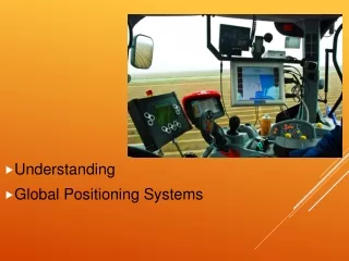
GPS Users • Agriculture • Construction • Mapping / GIS • Military – Guidance / Navigation • Navigation • Survey • Time Keeping • Network Synchronicity • Many Others
Agriculture – Planting Construction – GPS Controlled Grading
Kinematic GPS • Uses a stationary Receiver at a known location • Corrects for atmospheric errors • Ephemeris errors / other • Centimeter Accuracy in horizontal and vertical accuracy • Dual Frequency Receivers • Must have your own base station within close proximity to your collection site
Difference between DGPS & RTK (Trimble Website) • To get initialized, RTK needs a minimum of five satellites. After that it can operate with four. DGPS needs a minimum of three, though at least four are required for submeter accuracy. • For RTK, you need a dual frequency GPS receiver. Single frequency receivers are sufficient for DGPS. • For RTK, your GPS receiver must be capable of On-the-Fly initialization (obtaining centimeter accuracy while moving). For DGPS, this isn't necessary. • With RTK, it takes one minute to initialize. DGPS receivers initialize immediately. • You can expect accuracy of a few centimeters in all three dimensions using RTK. With DGPS, you can achieve sub-meter accuracy in horizontal position only. • To obtain GPS corrections for RTK, you need your own base station that is no more than ten kilometers from the field you are working in. For DGPS, you can use your own base station, a correction service provider, or make use of the free radio beacon broadcasts in many regions.
Other GPS Systems • GLONASS – Russia • 14 Satellites • Last three launched in June 2005 • 3 Orbital Planes • Galileo – Europe • 30 Satellites • 23 222 km / 75,459ft / 14.2miles • 14 hour orbit • Better polar coverage • Search and Rescue function • transponds distress signals / reply • Anticipated fully operational 2008
Future GPS Capabilities Generation III GPS • Adds L5 Carrier • 3rd signal for civilian use • available for initial operational capability by 2012 (Full 2015) • Enables ability for higher power signals • Improves ability to transmit more signals (data) • Improves the tolerance to interference • Improves susceptibility to self interference • Improves the dynamic rage of receivers • Can receive weaker signals without self interference • Enables operation in more stressful environments • wooded area, buildings, urban canyons