Global Positioning Systems and GIS An Introduction
290 likes | 480 Vues
Global Positioning Systems and GIS An Introduction. Tom Vought and Katie Franke. GPS and GIS. GPS = Global Positioning System Geocaching = an entertaining adventure game for GPS users.

Global Positioning Systems and GIS An Introduction
E N D
Presentation Transcript
Global Positioning Systems and GIS An Introduction Tom Vought and Katie Franke
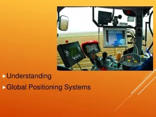
GPS and GIS • GPS = Global Positioning System • Geocaching = an entertaining adventure game for GPS users. • Individuals and organizations set up caches all over the world and share the locations of these caches on the internet. GPS users can then use the location coordinates to find the caches. • GIS = Geographic Information System • Any system for capturing, storing, analyzing, managing and presenting data and associated attributes which are spatially referenced to Earth. • Data capture = entering information into a GIS • Needs to be done well [garbage in garbage out] • Tends to be very time consuming • Positions from a GPS can also be directly entered into a GIS
GIS Defined • A geographic information system is a framework for understanding our world and applying geographic knowledge to solve problems and guide human behavior. • A GIS can produce information that answers specific questions and allows you to share that information with others. By visualizing relationships, connections, and patterns in data, you can make informed decisions and increase efficiency throughout your organization.
GIS Defined • Tool for visualizing and analyzing the interaction of spatial phenomena by overalying and displaying geodata layers • Interaction of • Software (ArcGIS) • Data (shapefiles, rasters) • Users (you)
Where is Manhattan? 39o 12’ N96o 35’ W 2,705 miles north of the Equator 5,126 miles west of the Prime Meridian 4,480 miles east of the International Date Line
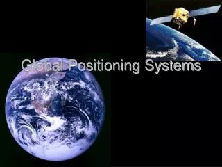
What is GPS? • GPS = Global Positioning System • Space-based (satellite) positioning system for navigation, tracking, and mapping • Designed and maintained by the U.S. Department of Defense • Global and available “24-7-365” Your location is: 37o 23.323’ N 122o 02.162’ W
Evolution of GPS – 1970s • Grew out of two US military projects that were combined into the Defense Navigation Satellite System (DNSS): • US Navy Timation Project • US Air Force 621B Project • DNSS led to Navstar (Navigation System with Timing and Ranging) – later referred to as Global Positioning System or “GPS”. • First generation of GPS satellites (Phases I and II) deployed.
Evolution of GPS – 1980s • 1984: No-cost civilian access to the GPS guaranteed by the US government. • 1989: First Phase III (Block II) satellites launched. • 1993: IOC (Initial Operation Capability) achieved with 24 fully functional satellites. • July 1995: FOC (Full Operational Capability) achieved, 24 fully functional Block II satellites.
Block II NAVSTAR GPS Satellite Name: NAVSTAR Manufacturer: Rockwell International Altitude: 12,544 Miles Weight: 1900 lbs. Size: 17 ft. (solar panels extended). Orbital Period: 12 hours Orbital Plane: 55° to equatorial plane Planned Lifespan: 7.5 years Thrusters for orbit adjustments Current Constellation: 29 Block II satellites
Other Systems • Beidou – China’s regional system; proposal to expand to global system called COMPASS • Galileo – global system proposed by EU for 2011-12 • GLONASS – Russia global system being restored with India • IRNSS – proposed regional system by India • QZSS – Japanese proposed regional system
How Does GPS Work? • Velocity of GPS radio signal is constant = 186,000 mi/sec • Need to measure travel time of signal from satellite to ground receiver. • GPS satellites have 4 onboard atomic clocks: 2 rubidium and 2 cesium. Distance = Velocity x Time
Introducing TrilaterationWith one data source… Three people are driving to the same destination, but we don’t know what the destination is. The first person starts at the red dot and drives in a straight line at 60 mph for 10 hours (600 miles), so they would be somewhere on the edge of this circle. 600 miles
Introducing TrilaterationAdd a second data source… The second person starts at the green dot and also drives in a straight line at 60 mph for 10 hours (600 miles), so they would be somewhere on the edge of their circle. This means that the destination must be on one of the two yellow dots. 600 miles 600 miles
Introducing Trilaterationand a third data source… Finally the third person starts at the purple dot and also drives in a straight line at 60 mph for 10 hours (600 miles), so they would be somewhere on the edge of their circle. This means that the destination must be on the yellow dot. 600 miles 600 miles 600 miles
Making Trilateration Harder! Even if the speed of and distance traveled by each vehicle was different – the process for identifying the destination would be the same. What is this distance?
GPS Trilateration Same as previous example, but backwards. “Destination” is known, but where were the three starting points?= Velocity x Time How do we measure the distance between person on the ground and each of three satellites?
How Does GPS Work? • Velocity of GPS radio signal is constant = 186,000 mi/sec • Need to measure travel time of radio signal from satellite to ground receiver. • Distance from three satellites mandatory, four gives a more accurate position fix. Distance = Velocity x Time
One-Way Satellite RangingDistance = Velocity x Time 90 milliseconds 40 milliseconds 50 milliseconds 0.050 x 186,000 = 9,300 miles 0.090 x 186,000 = 16,740 miles 0.040 x 186,000 = 7,440 miles
Sources of GPS Error • Slight errors in time measurement introduce large errors in distance – very precise clocks needed to measure time in billionths of seconds. • 1 millisecond mistake = 186 miles! • Major Sources of Positional Error: • Satellite/Receiver Clock Error • Receiver Noise • Atmospheric Delay • Multipath Error • Selective Availability
Atmospheric Delay GPS signals are delayed as they pass through the atmosphere Ionosphere Troposphere Less Error More Error
Selective Availability (S/A) • Government introduces artificial errors to reduce GPS position accuracy • With S/A on – no better than 100 meter accuracy • Turned off in 2000, but could be turned back on at any time… 100 meters 100 meters 40 meters 20 meters
Current GPS Status • U.S. Coast Guard Navigation Center • http://www.navcen.uscg.gov/gps/status_and_outage_info.htm • Latest GPS Status Message • http://www.navcen.uscg.gov/ftp/GPS/status.txt
GPS and GIS • GPS = Global Positioning System • Geocaching = an entertaining adventure game for GPS users. • Individuals and organizations set up caches all over the world and share the locations of these caches on the internet. GPS users can then use the location coordinates to find the caches. • GIS = Geographic Information System • Any system for capturing, storing, analyzing, managing and presenting data and associated attributes which are spatially referenced to Earth. • Data capture = entering information into a GIS • Needs to be done well [garbage in garbage out] • Tends to be very time consuming • Positions from a GPS can also be directly entered into a GIS