Download
1 / 20
210 likes | 500 Vues
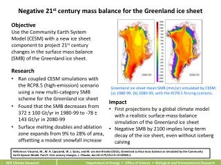
Seasonal Evolution of Supra-glacial Lakes at the Margins of the Greenland Ice Sheet. Malcolm McMillan 1 , Peter Nienow 1 , Andrew Shepherd 1 & Toby Benham 2. School of GeoSciences, University of Edinburgh. Scott Polar Research Institute, University of Cambridge.

E N D
Seasonal Evolution of Supra-glacial Lakes at the Margins of the Greenland Ice Sheet Malcolm McMillan1, Peter Nienow1, Andrew Shepherd1 & Toby Benham2 School of GeoSciences, University of Edinburgh. Scott Polar Research Institute, University of Cambridge.
Aim: To investigate seasonal changes in the volume of water stored by and released from supra-glacial lakes on the margin of the Greenland Ice Sheet. Combine satellite remote sensing and in-situ meteorology. WHY? Images from http://www.whoi.edu/oceanus
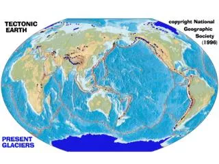
Observations: volume change Airborne laser altimetry 1993-99 Satellite (ERS) radar altimetry 1992-2003 cm/yr Krabill et al, 2000, Science Johannessen et al, 2005, Science + new GRACE and IceSat measurements
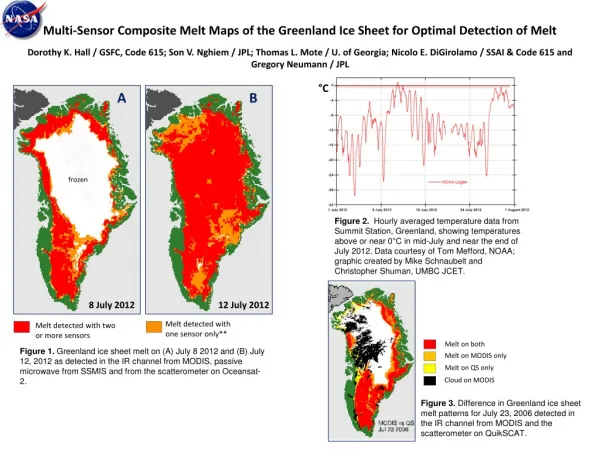
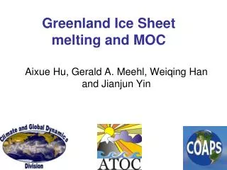
Observations: melt change Steffen and Huff, 2003. Greenland melt extent increased by 16% between 1979-2002
Observations: dynamic thinning • Ice sheet outlet glaciers are accelerating • 150 % acceleration of Jakobshavn Isbrae between 1985 and 2003 Joughin et al., 2004, Nature • ~2/3 of recent ice mass loss the result of dynamic thinning • Rignot and Kanagaratnam, 2006,Science.
Modelling: conventional evolution Alley et al., 2005, Science
Modelling: uncertainties Predicting the evolution of the GIS is complicated because of a critical lack of understanding of certain key processes: Dynamic response of ice sheet to increased meltwater production.
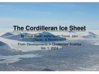
Dynamic response 0 – 5km Winter Summer Zwally et al., 2002, Science • Ice sheet interior accelerated during periods of summer melt. • Hypothesis: increased melt induces speed-up through enhanced basal sliding. • Behaviour typical of many polythermal and temperate glaciers. Bingham et al., 2003, Ann. Glac. Glacier velocity (% increase/decrease from annual mean)
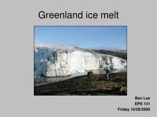
Supra-glacial lakes 22 June 1990. During summer, lakes up to several kilometers square form on the surface of the ice near the ice sheet margins. Landsat image in Zwally et al., 2002, Science. How do these lakes behave during the course of a melt-season? Image from http://www.whoi.edu/oceanus
Study Area 2 sites at the margin of the western GIS: Site 1) ‘Swiss Camp’ scenes (~70°N, ~49°W), 18,800 km2, ~400 - 2100 m elevation. Site 2) ‘Russell Glacier’ scenes (~67°N, ~48°W) 3000 km2, ~ 500 - 1200 m elevation. Landsat 7 ETM 30 m resolution Swiss Camp Scenes Greenland ASTER 15 m resolution Russell Glacier Scenes
Remote Sensing Data Compared images of both sites from early July 2001 and early August 2001. Survey of lake area conducted for lakes > 0.01 km2 on both dates. Swiss Camp Scenes Russell Glacier Scenes Landsat scene, 7th July 2001
Results - Remote Sensing Survey July 2001 August 2001 Substantial drainage of lakes at both sites. 1 km Draining of lakes at ~ 950m, Russell Glacier
Variations in lake behaviour with altitude. Russell Glacier • Swiss Camp: • Below 1200m: decrease in net lake area between 7th July and 1st August. • Above 1200m: increase in net lake area. Russell Glacier: Net decrease in lake area between 3rd July and 1st August at all altitudes. Swiss Camp
Hydrological Cycle These results suggest lakes situated at higher elevations / latitudes (i.e. lower temperatures) will be at an earlier stage in their seasonal evolution during the survey period. High elevation ‘Swiss Camp’ lakes: early stage of seasonal evolution: lakes filling Low elevation ‘Swiss Camp’ & all ‘Russell Glacier’ lakes: later stage of seasonal evolution: lakes draining Observations suggest a melt, fill and drainage cycle.
What about volume changes? • 1996 - 2005 Positive Degree Days (PDD’s) calculated from • GC-Net met. stations temp. data [Steffen and Box, 2001]. Russell Glacier Scene JAR1 JAR2 Swiss Camp Scene JAR3 SC Swiss Camp JAR1 JAR2 JAR3 GC-Net meteorological stations locations
Degree day model • PDD model used to estimate melt ‘upglacier’ of the Swiss Camp lakes. • Used degree day factors for ice (8 mm w.e.) and snow (3mm w.e.) from Braithwaite, J. Glac., 1995. 2nd image taken 1st image taken 2001 Positive Degree Days, Swiss Camp Region
Volume Results Total annual runoff produced in 2001 upglacier of the Swiss Camp lakes was estimated to be 3.15 km3. • 0.12 km3 before 7th July (first scene): • A further 0.97 km3 before 1st August (second scene). From surveyed lake area and estimated melt volumes: Mean July depth of Swiss Camp lakes = ~2 meters (assuming no drainage pre-July). Mean August depth of lakes continuing to fill = ~8 meters.
Volume Results cont. Volume water drained (c/w stored) by Aug. estimated: 0.65 km3 This equates to a mean sub-glacial water depth of 11cm below the area spanned by the lakes, should the water penetrate simultaneously to the ice sheet bed. It won’t but what is the rate of drainage? – better temporal resolution required + ground truthing!
Conclusions • 1) Supra-glacial lakes show a clear seasonal evolution. • 2) Volumes of meltwater draining from the lakes are substantial and could perturb ice-dynamics. • Two critical unknowns: • Does meltwater reach the bed? • If yes, does it: • i) rapidly develop a hydraulically efficient channelised drainage system (= Pw) or • ii) does ice overburden ensure the survival of a hydraulically inefficient distributed drainage (= Pw).
Acknowledgements This work was supported by a UK Natural Environment Research Council studentship (NER/S/M/2005/13876). Satellite data were provided by the Global Land Cover Facility (http://www.lancover.org) and the Land Processes Distributed Archive Centre (http://LPDAAC.usgs.gov). Meteorological data were provided by the Steffen Research Group (http://cires.colorado.edu/science/groups/steffen).