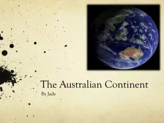
The Australian Continent
The Australian Continent . Chapter 1 Summary . Australia’s Geographical Dimensions (1.1). Australia is one of the seven continents of the world ( Aust. is the smallest of the seven continents.)

The Australian Continent
E N D
Presentation Transcript
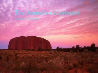
The Australian Continent Chapter 1 Summary
Australia’s Geographical Dimensions (1.1) • Australia is one of the seven continents of the world (Aust. is the smallest of the seven continents.) • The landmass of the Australian continent extends over an area of about 7682 million square kilometres . • Names of states and territories of Australia in order of size, from largest to smallest: Asia, Africa, Europe, North America, South America, Antarctica, Australia.
Australia’s Geographical Dimensions (1.1) • Name of capital cities of Australia in order of size, from largest to smallest: WA, QLD, NT, SA, NSW, VIC, TAS, ACT. • List of Australia’s seven external territories: - Heard Island and McDonald Islands • Norfolk Island - The Coral Sea Islands Territory • Christmas Island - The Australian Antarctic Territory • The Cocos (Keeling) Islands - The Territory Of Ashmore And Cartier Islands
Locating Australia (1.2) • Australia is located in the southern hemisphere, which it shares with the continents of Africa, South America and Antarctica. • Australia is also referred as being located in the eastern hemisphere, which it shares with East Asia and South Asia, New Zealand, the Pacific Islands and part of Antarctica. • The dividing line between the eastern and western hemispheres is the Prime Meridian.
Locating Australia (1.2) • Gross National Income (GNI): total value of goods and services produced in a country in one year per person plus net income from abroad. • Latitude: Imaginary lines drawn around the Earth from east to west; they represent distance north or south of the Equator, measured in degrees, minutes and seconds. • Longitude: Imaginary lines drawn around the Earth from north to south; they represent distance east or west of the Greenwich Meridian, measured in degrees, minutes and seconds.
Origins Of The Continent: Aboriginal Perspective (1.3) • Dreaming stories are important to Aboriginal people because it tells of a Dreamtime when all things began. They explained how the world came to be, providing a basic for people’s spirituality. They also provided rules to live by and sometimes warned of danger. • There are many different Dreaming stories because people spoke many different languages and had differing customs. The strong link between the people and their land was common to all. The land provided everything they needed to survive, and connected them and all living things with their powerful ancestral beings.
Origins Of The Continent: Geographical Perspective (1.4) • The broad shape of Australia and its distinctive landforms have been influenced over long periods by earth movements associated with tectonic processes. • The Earth’s crust is cracked and made up of many individual moving pieces called tectonic plates. • The plates are made of rock, but the rock, in general, compared with the denser, fluid layer underneath. This allows the plates to ‘float’ on top of the denser layer of rock.
Origins Of The Continent: Geographical Perspective (1.4) • The name of the supercontinent that contains all present continents is called Pangaea. • Fold Mountains areformed when one plate slides down under another. • Fault Mountains are formed when layers of rock are fractured and one section moves down and another section moves up.
Tectonic Processes And Volcanic Activity (1.5) • Mountains can be formed by folding and faulting processes, and also by volcanic activity. • The suggested reason of why Australia have volcanic activity is that the volcanoes appeared and were formed there during the continental drift.
Tectonic Processes And Volcanic Activity (1.5) • The Continental Drift is the theory to Australia’s volcanic landscapes however, there were hot spots as well which were present as the tectonic plates moved over the faults and there hot spots in the cause for this theory. • Mantle: the layer of the Earth between the crust and the core. • The caldera of the Tweed volcano is one of the biggest erosion calderas in the world- it is over 1000 metres deep and has a diameter of over 400 kilometres
Impacts Of Changing Climates And Sea Levels (1.6) • Scientist think the ancestors of Aboriginal people began to migrate to Australia about 50 000 years ago, during the Ice Age. • Australia is an ancient landmass. The Earth is about 4600 million years old and the Australian continent is about 4300 million years old. • Ice Age: a time in which the Earth is colder, resulting in the expansion if glaciers and ice sheets and a fall in sea level.
Impacts Of Changing Climates And Sea Levels (1.6) • During the last Ice Age, temperatures were much lower, and vast amounts of water became trapped in ice sheets and glaciers. The sea level was 100 metres lower than it is today. • With the end of the Ice Age, about 15 000 years ago, higher temperatures led to the retreat of ice sheets and glaciers, and sea levels gradually rose to their present levels.