Download

1 / 82
850 likes | 1.08k Vues
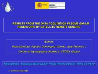
RESULTS FROM THE DATA ACQUISITION IN SOME GIG-LM RESERVOIRS BY SATELLITE REMOTE SENSING. Authors: Peña-Martínez, Ramón; Domínguez-Gómez, José-Antonio (*) Centre for Hydrographic Studies of CEDEX (Spain). Topic/subtopic : Ecological Water Quality, Photosynthetic pigments, Remote sensing.

E N D
RESULTS FROM THE DATA ACQUISITION IN SOME GIG-LM RESERVOIRS BY SATELLITE REMOTE SENSING Authors: Peña-Martínez, Ramón; Domínguez-Gómez, José-Antonio (*) Centre for Hydrographic Studies of CEDEX (Spain) Topic/subtopic : Ecological Water Quality, Photosynthetic pigments, Remote sensing (*) External collaborator
common “WFD assessment method” in the GIG. In the L-M GIG, the common method comes to be the assessment of chlorophyll concentration from a sample collected at, or immediately below, the water surface, once in summer season. … as an interim common method for IC purposes until a more sufficient method is implemented, in search of a more reliable outcome. More specifically, an improved chlorophyll assessment method could be agreed among the GIG countries, increasing somewhat the annual number of samples and adopting a common sampling strategy. As an alternative approach to increased sampling, or in addition to it, satellite remote sensing imagery may provide a valuable tool in monitoring the variability of algal biomass and assessing the mean summer values of chlorophyll concentration at water surface.
From 1999 to 2005 CEDEX developed the ESA Project AOE-594 . “Development of an Operational System for direct Thematic Mapping of Photosynthetic Pigments in Lakes using MERIS. Application to the Spanish reservoirs”. In the working plan was included many field activities in order to built an comprehensive data bank of many spanish reservoirs integrating radiometric information on water optics, in situ profiling of several pigment and other parameters and integrated sampling in the 1st optical layer to analysis by HPLC method 19 pigments. After CEDEX was developed reflectivity models to assess Chlorophyll a and other pigment concentration in water bodies to applied to MERIS imagery and to any other multi or hyperspectral images of reservoirs. In that campaigns was used somedeviceto assure the same conditions in the radiometric measurements by the field spectro-radiometer . In addition has used a probe CTD and multiflorimeter for pigments. (in the next slides)
Observation Zenithal angle Controler = 40º ф = 135º Spectralon 25% ASD-FR Azimuthal angle from Sun position Controler 10-13 Above Water Measurement Device Optical fibre
Commuter Spectro-radiometer 10-13 ASD Spectro-radiometer on the working boat
INTEGRATED SAMPLE Temp. 21,7 ºC [chl a] 6,3 mg/l [FC] 21,6 mg/l [FE] 0,8 mg/l 10-13 TYPICAL MULTIPARAMETRICAL PROBE PROFILE
10-13 10-13 REFLECTIVITY MODELS We found a very good linear relationship for chlorophyll a, (R2=0.919) using the ratio between bands 9 and 7. B9 / B7 > 1
CEDEX Proposal for 2005 chris/Proba activities: “Use of CHRIS imagery for Monitoring Ecological Water Quality in smallest Mediterranean Reservoirs integrated in the Intercalibration Exercise of WFD Implementation Process” (AO 3123) Authors: Peña-Martínez, Ramón; Ruiz-Verdú, Antonio; Domínguez-Gómez, José-Antonio Centre for Hydrographic Studies of CEDEX (Spain) Topic/subtopic : Ecological Water Quality, Photosynthetic pigments, Remote sensing
Proba experimental satellite : 2 sensors; weigth 94 kg; ESA third party mission Sensor CHRIS / Proba satellite : 17 m spatial resolution; 5 angles image set; 15 km frame; 18 spectral bands in the mode 2 water.
Rosarito reservoir. Central Spain, Tietar river, Tajo river basin CHRIS/Proba image
2005 CHRIS/Proba image set acquisition 0 Bezid 29.05.2005 (no in the frame) Sacele 08.07.2005 * Cucchinadorza 18.11.2005 (too late) * Punta Gennarta 22.07.2005 Kouris 05.06.2005 Asprokremmos 11.09.2005 * Finally no included in the IC process 0 No image Only 3 available image sets along the summer Then...
ENVISAT-1 operational satellite : 10 sensors; weigth 8500 kg; ESA Earth Observation mission Sensor MERIS / ENVISAT satellite : 300 m spatial resolution; 1050 km frame; 16 spectral bands in the visible spectrum specially focused on ocean colour and environmental applications.
Satellite images orders (received R) MERIS / ENVISAT-1 images CHRIS/Proba images acquired: Bezid 29.05.05 bad pointing Kouris 05.06.05 Sacele 08.07.05 Punta Gennarta 22.07.05 excluded IC Asprokremmos 11.09.05 Cucchinadorza 18.11.05 excluded IC
Kouris Asprokremmos Lefkara
11-09-2005 Asprokremmos CHRIS/Proba
0 5 10 15 20 25< [Chla] (mg/m3) 11-09-2005 [Chl a] (mg/m3) ○ 4,45426 Mean value: 5,0379 Asprokremmos CHRIS/Proba
0 5 10 15 20 25< [Cla] (mg/m3) 04-05-2005 17-05-2005 05-06-2005 18-06-2005 08-06-2005 24-06-2005 Asprokremmos MERIS
0 5 10 15 20 25< [Cla] (mg/m3) CHRIS (11.09.05) ○ 4,45426 Mean value: 5,0379 20-07-2005 11-08-2005 07-07-2005 RS sp mean 1,490 RS mv mean 1,220 Photic l. mean 1,980 14-08-2005 15-09-2005 18-09-2005 Asprokremmos MERIS
05-06-2005 Kouris CHRIS/Proba
0 5 10 15 20 25< [Cla] (mg/m3) 0 5 10 15 20 25< [Chla] (mg/m3) 05-06-2005 [Chl a] (mg/m3) ○ 2,3256 Mean value: 1,8619 Kouris CHRIS/Proba
0 5 10 15 20 25< [Cla] (mg/m3) 17-05-2005 05-06-2005 04-05-2005 cloudy 08-06-2005 18-06-2005 24-06-2005 Kouris MERIS
0 5 10 15 20 25< [Cla] (mg/m3) CHRIS (05.06.05) ○ 2,3256 Mean value: 1,8619 CHRIS (05.06.05) ○ 2,3256 Mean value: 1,8619 RS sp mean 1,367 RS mv mean 1,272 Photic l. mean 1,800 07-07-2005 20-07-2005 11-08-2005 14-08-2005 15-09-2005 18-09-2005 Kouris MERIS
0 5 10 15 20 25< [Cla] (mg/m3) 04-05-2005 17-05-2005 05-06-2005 08-06-2005 18-06-2005 24-06-2005 Lefkara MERIS
0 5 10 15 20 25< [Cla] (mg/m3) RS sp mean 1,607 RS mv mean 1,677 Photic l. mean 0,383 07-07-2005 20-07-2005 11-08-2005 14-08-2005 15-09-2005 18-09-2005 Lefkara MERIS
TM/LANDSAT 5 MERIS
08-07-2005 Sacele CHRIS/Proba
0 5 10 15 20 25< [Chla] (mg/m3) 08-07-2005 [Chl a] (mg/m3) ○ 1,299 Mean value: 0,8227 Sacele CHRIS/Proba
0 5 10 15 20 25< [Cla] (mg/m3) CHRIS (08.07.05) ○ 1,299 Mean value: 0,8227 RS sp mean 1,487 RS mv mean 0,886 Photic l. mean 0,543 RS sp mean 1,010 RS mv mean 0,886 Photic l. mean 0,543 Excluding 2 data 04-06-2005 17-06-2005 22-06-2005 cloudy 26-06-2005 27-07-2005 31-07-2005 22-08-2005 Position error ? Sacele MERIS
0 5 10 15 20 25< [Cla] (mg/m3) RS sp mean 1,544 RS mv mean 0,969 Photic l. mean 1,393 RS sp mean 0,952 RS mv mean 0,969 Photic l. mean 1,393 Excluding 3 data 04-06-2005 17-06-2005 22-06-2005 26-06-2005 27-07-2005 31-07-2005 22-08-2005 Position error ? Izvorul Muntelui MERIS
0 5 10 15 20 25< [Cla] (mg/m3) RS sp mean 1,467 RS mv mean 0,969 Photic l. mean 2,027 04-06-2005 17-06-2005 22-06-2005 26-06-2005 27-07-2005 31-07-2005 22-08-2005 Siriu MERIS
0 5 10 15 20 25< [Cla] (mg/m3) RS sp mean 3,548 RS mv mean 6,141 Photic l. mean 2,363 RS sp mean 1,978 RS mv mean 1,147 Photic l. mean 2,363 Excluding 1 date 04-06-2005 17-06-2005 22-06-2005 Sun glint ? 26-06-2005 27-07-2005 31-07-2005 22-08-2005 Colibita MERIS