Download
1 / 20
250 likes | 647 Vues
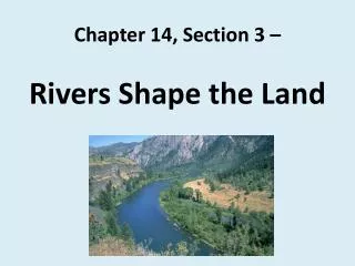
Chapter 14, Section 3 – Rivers Shape the Land. “In rivers, the water that you touch is the last that has gone before and the first of what is still to come.” Leonardo da Vinci - artist, inventor, scientist (1452–1519) What does this quote mean to you?.

E N D
“In rivers, the water that you touch is the last that has gone before and the first of what is still to come.”Leonardo da Vinci - artist, inventor, scientist (1452–1519) What does this quote mean to you?
REWIND!!!Tell the person across from you what weathering means.Tell the person sitting beside you what erosion means. Finally, discuss with your group how the two terms are related.
Rivers continually shape and change the land by moving sediment. Erosion by rivers is an important part of why land looks the way it does at any given time.
Rivers of Running WaterRiver valleys – Valleysare low-lying land features that are surrounded by higher land features such as hills and mountains.
Glaciers scrape U-shaped valleys through land areas, but rivers tend to cut V-shaped valleys.Why, do you suppose, that is the case?
Floodplain - ∙ flat land alongside a river that tends to flood∙ forms over time as the river erodes the land at each of its sides∙ very good land for growing plants due to nutrients being deposited by seasonal flooding∙ not ideal for buildings or homes due to seasonal flooding
MeandersSome rivers form S-shaped curves called meanders. Water flows at different speeds in different parts of the river.
This is an aerial view of the Altamaha River at the border of Glynn and McIntosh Counties. Can you see the s-shaped curve? Where would the water be moving the fastest? The slowest? Where would erosion be taking place, and where would deposition be taking place?
The fastest flow is on the outside of each curve, or meander, while the slowest flow is on the inside.Fast-moving water picks up particles. Slow-moving water drops particles so that they settle to the bottom of the river. The fast-moving water erodes the outside river bank while the slower water deposits sediment on the inside bank (erosion & deposition).
Did you know? The word “meander” is from the Greek word maiandros meaning “to flow in a winding course.”The origin of meander, maiandros, is named in honor of the historical Menderes River, which is now known as BuyukMenderes River located in Turkey. The river is named for its winding path that it travels as it flows towards the Aegean Sea.And now you know!
Over time meanders gradually change shape and migrate across the floodplain. As they do so meander bends becomes pronounced due to further lateral, or sideways, erosion and eventually an oxbowlake may form.
A braided streamhas many channelsthat criss-cross each other. Braided streams get their names from the braided appearance of their many channels.
A delta is a landform that is formed at the mouth of a river where that river flows into an ocean, sea, estuary, lake, reservoir, flat arid area, or another river. Deltas are formed from the deposition of the sediment carried by the river as the flow leaves the mouth of the river. Over long periods of time, this deposition builds the characteristic geographic pattern of a river delta.
This picture shows the Altamaha River delta. The Atlantic Ocean is in the distance. The photograph was taken on Dec. 29, 2010, by James Holland, former Riverkeeper of the Altamaha.
Riddle Me This….I have a head and a mouth, but no eyes, ears, or nose.I can run without ceasing, but have no legs, feet, or toes!I am wild and free, but kept in a bank.I pass through cycles of aging. Young, mature, or old may be my rank. I can twist and turn without rhyme or reason. I can change color, too, but not necessarily with the season.What am I?
You guessed it! I am a river!Can you think of other words or phrases to describe rivers?