Geo-Spatial Information in Decision Making and Development Planning
Explore the crucial role of geo-spatial information in decision-making and development planning. Learn how this specialized data influences the decision-making process and contributes to sustainable development. Gain insights from a comprehensive model that integrates spatial knowledge constructs, rationality in decision-making, and information processing.

Geo-Spatial Information in Decision Making and Development Planning
E N D
Presentation Transcript
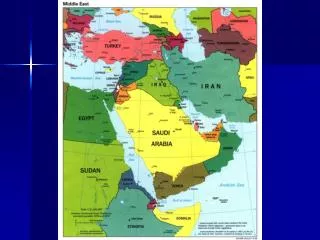
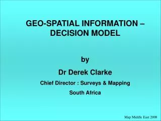
Map Middle East 2008 GEO-SPATIAL INFORMATION – DECISION MODEL by Dr Derek Clarke Chief Director : Surveys & Mapping South Africa
Opening statements: • Decision-makers and policy-makers are generally map illiterate and unable to use geo-spatial information or do not use geo-spatial information; • Geo-spatial professionals have difficulty to convince decision-makers and policy-makers of their contribution.
Decision-makers and policy-makers need to appreciate the use of geo-spatial information in decision-making process and be capable of using geo-spatial information; • Geo-spatial professionals must understand the work of decision-makers and policy-makers and be able to relate to / communicate with them.
participatory Development Development planning Development planning process Decision-making process Information - Knowledge Geo-spatial information – spatial knowledge Decision-making (geo-spatial) in context
Does geo-spatial information play a role in decision-making and development planning? Information is key in decision-making and development planning Geo-spatial information is a particular type of information Deduction : Geo-spatial information plays a key role in decision-making Is this an adequate, convincing argument!
Further Arguments: • It has been claimed that as much as 80% of decisions are spatially-related, and therefore require geo-spatial information; • UN’s Agenda 21 various action items require geo-spatial information; • Johannesburg Plan of Implementation (WSSD) reaffirmed essential role of geo-spatial information in development planning and decision-making; • The use of geo-spatial information in the development planning process (and public decision-making) in South Africa has been empirically tested; • Evidence through numerous actual experiences …
GEO-SPATIAL INFORMATION – DECISION MODEL • Model is an information/knowledge-centric model based on: • development planning process; • nature and process of decision-making; • general model of information use; • visual information processing; • spatial knowledge constructs; • open systems approach; • principle of rationality in decision-making – achieving highest possible level of rationality.
Signals from environment Monitoring Information cognitive sub-system Decision-making process Impact / change to environment Technical sub-system Impact / change Knowledge sub-system External knowledge Implementation Internal / specific environment External environment Geo-spatial Information – Decision Model (generalised) Community / Societal Problem or Opportunity
Signals from Environment • Observations : geo-spatial / non-spatial • : direct / remotely sensed; • Reports; • Statistics; • Geo-spatial databases; • Images; • Measurements; • Experiences; • Media; • Development objectives; • Policies
Signals from environment Monitoring Information cognitive sub-system Decision-making process Impact / change to environment Technical sub-system Impact / change Knowledge sub-system External knowledge Implementation Internal / specific environment External environment Geo-spatial Information – Decision Model (generalised) Community / Societal Problem or Opportunity
Information Cognitive Sub-system Geo-spatial data Other data Request more data Sense-making visual perception; filters; interpretations; cultural; experiences; knowledge; psychological Technical sub-system information processing support Information Information needs shared meanings; purpose Information Decision-making Process Gap Information seeking Information need Knowledge-creating Knowledge base Knowledge Sub-system
Signals from environment Monitoring Information cognitive sub-system Decision-making process Impact / change to environment Technical sub-system Impact / change Knowledge sub-system External knowledge Implementation Internal / specific environment External environment Geo-spatial Information – Decision Model (generalised) Community / Societal Problem or Opportunity
Knowledge Sub-system Information Cognitive Sub-system Knowledge-creating Knowledge base Knowledge Technical sub-system processed information Declarative Procedural Configurational knowledge Cultural Decision-making process knowledge Tacit Explicit Cognitive map Experience Long-term memory Cultural, Tacit, Explicit knowledge External knowledge Experience
Signals from environment Monitoring Information cognitive sub-system Decision-making process Impact / change to environment Technical sub-system Impact / change Knowledge sub-system External knowledge Implementation Internal / specific environment External environment Geo-spatial Information – Decision Model (generalised) Community / Societal Problem or Opportunity
Technical Sub-system • Decision Support System • Geographical Information System • Includes: • Routines / algorithms; • Transformations; • Spatial analysis; • Spatial modeling; • Spatial statistics; • Simulations; • Visualization; • Generalisation; • Decision rules / decision trees; • Forecasting; • Multi-criteria decision analysis; • Linear programming N.B. Technical Sub-system does not make decisions
Signals from environment Monitoring Information cognitive sub-system Decision-making process Impact / change to environment Technical sub-system Impact / change Knowledge sub-system External knowledge Implementation Internal / specific environment External environment Geo-spatial Information – Decision Model (generalised) Community / Societal Problem or Opportunity
Information cognitive sub-system Knowledge sub-system Decision-making Process Decision problem / opportunity Monitor Information Formulation/ analysis of problem/ opportunity Information need Develop alternatives Technical Sub-system Evaluate alternatives Knowledge Selection Experience Implementation
The Geo-spatial Information – Decision Model highlights the dependency of the development planning process and public decision-making on geo-spatial information and spatial knowledge.
Applying the Geo-spatial - Decision Model to the demarcation of voting districts and selection of voting stations (in South Africa)
Problem: • To prepare a voters roll with optimally demarcated voting districts, and to select appropriate venues for voting stations. • Criteria set: • Urban voting district to consist of 3000 voters, and rural voting districts to consist of 1200 voters. • Voting stations to be located within 7.5km in urban and 10km in rural areas travel distance. • Voting station to be at public building with adequate security.
Decision: • Determine voting districts • Information Need (1): • Population census data, demarcated into enumerator areas; • Enumerator areas geo-spatially represented • Technical sub-system: • - Aggregate enumerator areas to achieve population size of voting district • - Demarcate (geo-spatially) draft voting district from boundaries of enumerator areas
Decision: • Select voting station • Information need (2) • Locate suitable public buildings for voting station: public buildings – filter for security facilities • 10km travel distance of all voters : address of voter, location of possible voting station • Technical sub-system: • - Proximity analysis
Decision: • Are draft voting districts and proposed voting stations acceptable • Information need: • Community areas – any political conflict • Transport route to voting stations - roads • Barriers to travel distance – river, dam, highway, mountain, impassible area Technical sub-system: • boundary intersection, neighbourhoods • actual distance travelled
Initial demarcation … Roads Railways Populated areas Voting district Voting station
Amended voting district Roads Railways Populated areas Dams Rivers Voting district Verify travel distance to voting station
Check for barriers for access to voting station – river, dam, mountain, highway – actual travel distance Roads Railways Populated areasDams Rivers 20 m Contours Voting district Voting station
Implementation: Each voter notified of voting district and nearest voting station (ready for voting) Monitor: - Changes in population census (voters) - Changes to factors affecting voting district demarcation and selection of voting station
THOUGHTS ON ENHANCING PUBLIC POLICY FORMULATION AND DEVELOPMENT PLANNING • Acknowledge the key role of geo-spatial information in public decision-making / development planning / public policy formulation; • Use development planning process which emphasises the use of information and knowledge to achieve the highest possible level of rationality; • Use the Geo-spatial Information – Decision Model; • Provision of geo-spatial information which is relevant (appropriate to the purpose; received by the user timeously; in a format in which it can easily be used; and, reliable);
THOUGHTS ON ENHANCING PUBLIC POLICY FORMULATION AND DEVELOPMENT PLANNING (cont.) • Ensure easy access to relevant geo-spatial information (policies, procedures, standards, systems and organisational remits – i.e. SDI); • Ensure that reliable supporting infrastructure (communications, electrical power) is in place; • Development planning process must be participatory; • Geo-spatial information and technology must be usable by all – skills development (particularly functional map literacy). • Thank you